Photos with GPS coordinates (geotagging)
In brief: BauMaster stores GPS coordinates automatically with your photos. In the map view under “drawings & documents” you see where each photo was taken and can correct or set the position manually if needed.
Prerequisites: a device with GPS, the granted location permission for BauMaster, and an Expert licence.
GPS/geotagging or photo marker? GPS / geotagging stores the device’s automatic location data and shows photos in a map view. A photo marker locates a photo manually at a place on the PDF drawing (drawing-based working) — see Locate a photo and create photo markers.
Note on accuracy
Under unfavourable conditions — poor geographic location, bad weather, an unstable internet connection or older devices — GPS positioning can fail or deviate significantly from the actual position. Check the location manually if needed.
Enable the GPS function
Photos you take outside BauMaster with the device camera usually already contain GPS coordinates. So that photos taken directly in BauMaster also get coordinates, enable the GPS function:
- confirm the prompt on first camera access, or
- in the camera settings (visible on mobile devices only, reachable via the account menu at the top right).
Location permission declined? If you explicitly did not allow location access on the first prompt, you cannot undo that in BauMaster. Grant the permission in your device settings instead (Android or iOS) — see App permissions on your device.
View photos in the map view
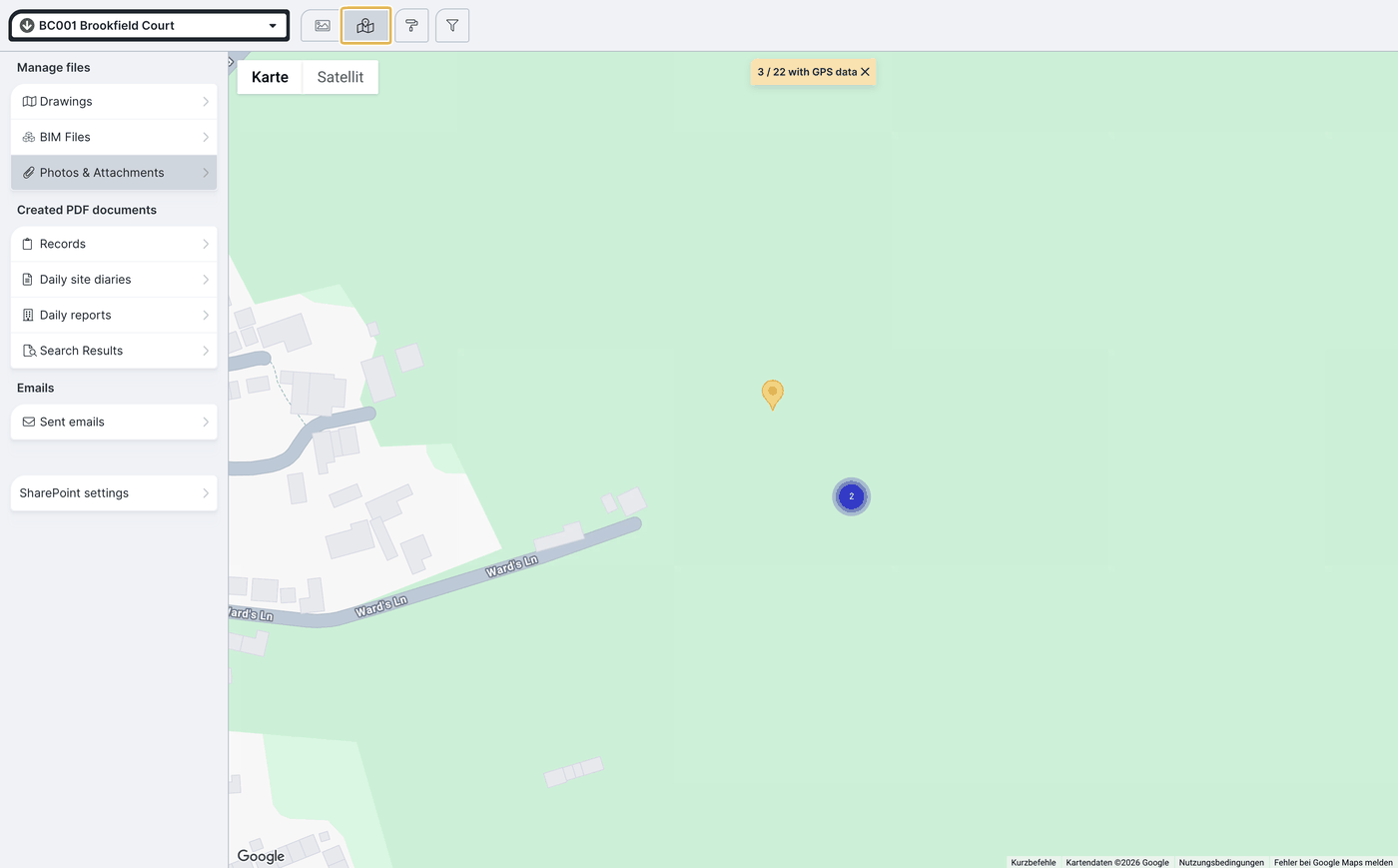
Open drawings & documents → photos & attachments and switch to the map view. That shows at a glance where all photos with GPS coordinates were taken. Photos per location can be viewed together, downloaded, moved to another project or deleted.
Change the GPS position
- Click the photo.
- Switch to the map view.
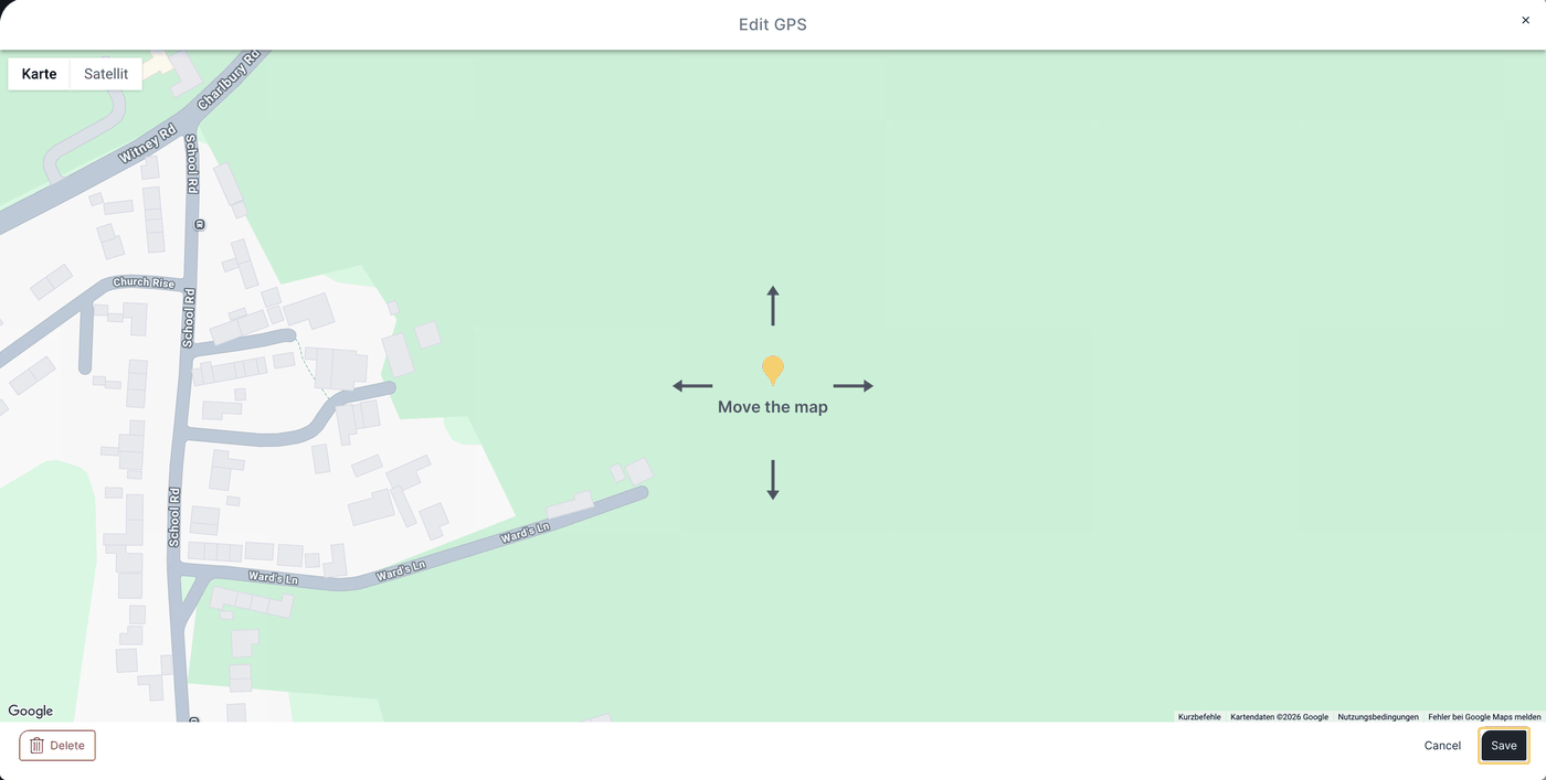
- Choose edit GPS and move the map to the place you want.
- Click Save.
Store GPS coordinates manually
If a photo has no coordinates yet, the button for switching the preview changes: you can then set a GPS position manually by moving the map to the place you want and saving.
FAQ
Why is the GPS coordinate missing on some photos?
Location is probably disabled on the device in general. BauMaster cannot access it — please enable location in the device settings.
I declined the location permission for BauMaster — how do I grant it again?
Only via your device settings (Android or iOS). In BauMaster itself the refusal cannot be undone.
The coordinates are wrong — can I improve that?
Accuracy varies by device and environment. On Android the “high accuracy” setting helps (location → locating method). Alternatively correct the position manually via “edit GPS”.
Do I need a specific licence for geotagging?
Yes, GPS/geotagging is part of the Expert licence.
On my Surface device I cannot switch between front and rear camera — what can I do?
Choose the camera you want in the Edge browser settings under “camera”.
Keywords: photo geotagging